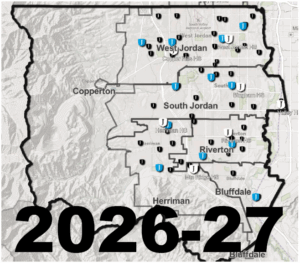
 Planning and Enrollment's School Boundary Look Up
This map shows the school boundaries where an address resides. Click the map or school year with dates link to determine which school your student should attend. If you wish to attend a school other than your boundary school, please go to our School Choice/Permits page.
School Year 2026-27: Aug 18, 2026 - June 7, 2027
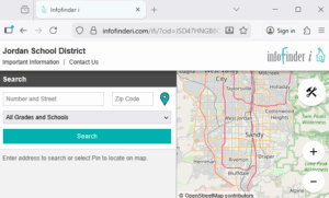
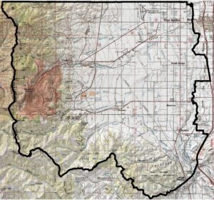
Transportation's "InfoFinder" Bus Stop Look Up
Find bus stop/boundary information here. Please note that bus stops are subject to change over the summer, and will be finalized on July 25. "Space Available" passes will be considered on or after August 1. Questions regarding busing, routes and "Space Available passes" should be directed to our Transportation Department at 801-567-8840.
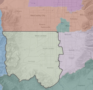
Next School Year 2026-27 Boundaries
Elementary Boundaries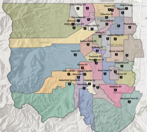 |
Middle Boundaries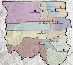 |
High Boundaries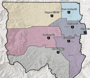 |
Other Helpful Boundaries
| UT School Districts
|
School Locations (pdf) |
JSD Misc. Map Gallery
|
How Boundaries are Determined
Boundaries are determined using comprehensive demographic planning software built from GIS technology specifically developed for the needs of school districts, along with input from various local sources such as the Board of Education, city leaders, district administrators, and patrons. Information about upcoming boundary changes is posted on the Jordan District website at boundary.jordandistrict.org. School district households affected by a boundary change are notified in advance of any changes that might affect them.