| To determine which school your student should attend, click the yellow school bus icon. If the address indicates your student is "eligible" for a bus, click the school's link to see the available bus stops. You may also confirm bus stop information with the Transportation Department at 801-567-8840 or your local school. |  |
Boundary Maps
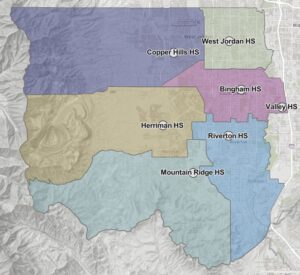 High Schools High Schools |
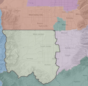 UT School Districts UT School Districts |
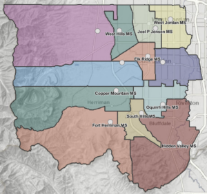 Middle Schools Middle Schools |
|
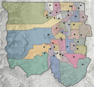 Elementary Schools Elementary Schools |
 JSD Map Gallery JSD Map Gallery |
How Boundaries are Determined
Boundaries are determined using comprehensive demographic planning software built from GIS technology specifically developed for the needs of school districts, along with input from various local sources such as the Board of Education, city leaders, district administrators, and patrons. Information about upcoming boundary changes is posted on the Jordan District website at boundary.jordandistrict.org. School district households affected by a boundary change are notified in advance of any changes that might affect them.